Cebu, PHILIPPINES- Tropical Depression "Crising" is finally out to the Philippine Area of Responsibility. At 4:00pm PAGASA, last located the center of the storm at 200 km west of Balabac, Palawan (8.0°N, 115.1°), packing a winds up to 45 kph and is moving west-northwest at 22 kph. Meanwhile, U.S Navy (JTWC) issued the final and last warning of the system and the Japan Meteorological Agency still issuing a warning.
Meanwhile Visayas (specially over Samar Is.) and Mindanao can still expect scattered light rains. Going further to the north (particularly over Eastern Luzon) expect light rains because of the Northeast Monsoon, the rest of Luzon including Metro Manila will experience fair weather except for those passing light rains.
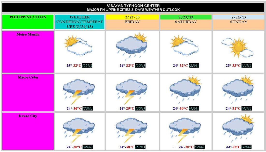
Here are the PHILIPPINE CITIES WEATHER OUTLOOK (3-DAYS) {NOT OFFICIAL}
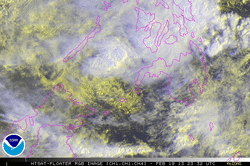
Satellite Image of TD Crising
Cebu, PHILIPPINES- Tropical Depression Crising {02W} is now emerging Sulu Sea, at 4:00 am (PHT Time) the depression was last located 140 km northwest of Zamboanga City (7.5°N, 120.8°E). It's maximum sustained is still 45 kph . The depression is expected to move West Northwest at 24 kph, towards Southern Palawan.
(PSWS # 1: Southern Palawan, Zamboanga del Norte, Zamboanga del Sur, Zamboanga Sibugay, Basilan and Sulu)
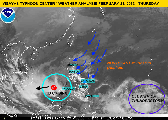
• The rainbands of TD Crising is beginning to move north along Palawan,Visayas (particularly over Negros Oriental, Cebu, Bohol, Leyte, Samar and Siquijor) which means this areas will experience moderate to heavy rains to at times intense with gusty winds. By this afternoon MIMAROPA, CALABARZON and even in NCR we expect some light rains.
FORECAST OUTLOOK:
According to PAGASA 'Crising' is expected to be at 300km southwest of Puerto Princesa City tomorrow morning and by tomorrow afternoon it is expected to be at 570km southwest of Puerto Princesa.
GALE WARNING over EASTERN & CENTRAL VISAYAS and EASTERN MINDANAO
Due to Tropical Depression Crising PAGASA raised Gale Warning over the seaboards of Eastern and Central Visayas and the seaboards of Eastern Mindanao which means expect rough to very rough sea condition, fishing boats and other small sea crafts are advised not to venture over the said areas because/due to high waves.
Meanwhile a Low Pressure Area(LPA) has been located approximately 220 km Northwest of Puerto Princesa,Palawan (11.0°N, 117.0°E)
LATEST UPDATE OF LPA {98W}
LOCATION: outside of PAR / 351 km southeast of Palau Island / 1, 210 km east of Southern Mindanao
COORDINATES (per-weather-agency)
PAGASA : 6.0°N, 138.0°E
Japan Meteorological Agency : 6.0°N , 137.0°E
U.S Navy (JTWC) : 5.4°N, 137.1°E
MAXIMUM SUSTAINED WINDS{JTWC}: 18 kph to 27 kph (10 to 15 knots)
MINIMUM SEA LEVEL PRESSURE: 1004 MB
SEA SURFACE TEMPERATURE (over the LLCC): 28° to 30°C
MOVEMENT: WEST SLOWLY
CHANCE OF BECOMING A TROPICAL CYCLONE: LOW (>30%)
With this weather disturbance we've raised rainstorm warning which means expect moderate to heavy rains (5.0 to 15.0 mm/hr) which may trigger flash floods or landslide :
Rainstorm warning #2 (within 6 to 12 hrs.)
The whole Mindanao, Southern Negros, Southern Cebu, Siquijor, Bohol and Southern Leyte
Rainstorm warning #1 (within 12 to 24 hrs.)
Rest of Visayas and Palawan
[Note: Do not used this advisory/warning as life decision]
 RSS Feed